SPECIAL WEATHER STATEMENT – 12-28-15

FROM: NATIONAL WEATHER SERVICE GREEN BAY

ONEIDA-FOREST-FLORENCE-NORTHERN MARINETTE COUNTY-LINCOLN-LANGLADE-
MENOMINEE-NORTHERN OCONTO COUNTY-DOOR-MARATHON-SHAWANO-WOOD-
PORTAGE-WAUPACA-OUTAGAMIE-BROWN-KEWAUNEE-WAUSHARA-WINNEBAGO-
CALUMET-MANITOWOC-SOUTHERN MARINETTE COUNTY-
SOUTHERN OCONTO COUNTY-
830 PM CST MON DEC 28 2015


..MAJOR WINTER STORM CONTINUES TO PRODUCE DANGEROUS TRAVEL
CONDITIONS LATE THIS EVENING…


MODERATE TO HEAVY SNOW…IN COMBINATION WITH SUSTAINED WINDS OF 20
TO 30 MPH…WITH PEAK WIND GUSTS RANGING FROM 35 TO 45 MPH WILL
CONTINUE TO SEVERELY IMPACT TRAVEL ACROSS MUCH OF CENTRAL AND
NORTHEAST WISCONSIN THIS EVENING. SNOWFALL RATES OF UP TO 1 INCH
PER HOUR ALONG WITH THE STRONG EASTERLY WINDS WILL OCCASIONALLY
PRODUCE NEAR WHITEOUT CONDITIONS. THE AXIS OF HEAVIEST SNOW IS
EXPECTED TO EXTEND FROM NEAR STURGEON BAY AND MARINETTE…SOUTHWEST
ACROSS THE GREEN BAY AND SHAWANO AREAS…TO NEAR MARSHFIELD AND
WISCONSIN RAPIDS. BY MIDNIGHT…THESE AREAS COULD SEE SNOWFALL
ACCUMULATIONS RANGING FROM 6 TO 10 INCHES…WITH LOCALLY HIGHER
AMOUNTS. SOME SLEET IS ALSO LIKELY TO MIX IN WITH THE SNOW OVER
PARTS OF MANITOWOC…CALUMET AND WINNEBAGO COUNTIES FOR THE NEXT
FEW HOURS.


THE MODERATE TO HEAVY SNOW…ALONG WITH THE STRONG EAST TO
NORTHEAST WINDS SHOULD BEGIN TO DIMINISH AFTER MIDNIGHT ACROSS THE
FOX VALLEY…WITH AREAS OF FREEZING DRIZZLE AND OR LIGHTER SNOW
PERSISTING UNTIL TUESDAY MORNING. THE MODERATE SNOW WILL CONTINUE
TO THE NORTH AND WEST OF GREEN BAY AFTER MIDNIGHT.


THE LATEST WISCONSIN ROAD CONDITIONS CAN BE OBTAINED BY CALLING
511.

NWS – HIGHEST WIND REPORTS PAST 6 HOURS 12-28-15

FROM: National Weather Service Green Bay Office

PUBLIC INFORMATION STATEMENT
NATIONAL WEATHER SERVICE GREEN BAY WI
347 PM CST MON DEC 28 2015
…HIGHEST WIND REPORTS PAST 6 HOURS …

LOCATION SPEED TIME/DATE LAT/LON
ALGOMA CITY MARINA 45 MPH 0251 PM 12/28 44.61N/87.43W
PLOVER 1 WSW 41 MPH 0147 PM 12/28 44.44N/89.55W
SCANDINAVIA 40 MPH 0111 PM 12/28 44.46N/89.15W
COMBINED LOCKS 2 W 38 MPH 0115 PM 12/28 44.24N/88.34W
TWO RIVERS 8 ESE 38 MPH 1000 AM 12/28 44.10N/87.40W
OSHKOSH AIRPORT 37 MPH 0253 PM 12/28 43.98N/88.56W
WHITEFISH BAY 9 SE 37 MPH 1000 AM 12/28 44.80N/87.10W
ROSE LAWN 4 SE 36 MPH 0236 PM 12/28 44.54N/88.25W
MARSHFIELD AIRPORT 36 MPH 0236 PM 12/28 44.64N/90.19W
STEVENS POINT AIRPORT 36 MPH 0115 PM 12/28 44.55N/89.53W
KEWAUNEE 34 MPH 1018 AM 12/28 44.47N/87.50W
WAUSAU AIRPORT 33 MPH 1227 PM 12/28 44.93N/89.63W
MOSINEE AWOS 33 MPH 0250 PM 12/28 44.78N/89.67W
CLINTONVILLE AWOS 32 MPH 0235 PM 12/28 44.61N/88.73W
SHAWANO AIRPORT 32 MPH 1040 AM 12/28 44.79N/88.56W
MANITOWOC AWOS 32 MPH 1035 AM 12/28 44.13N/87.68W
ANTIGO AWOS 31 MPH 0135 PM 12/28 45.15N/89.11W
OMRO 31 MPH 0951 AM 12/28 44.03N/88.75W
RHINELANDER AIRPORT 31 MPH 0120 PM 12/28 45.63N/89.47W
STURGEON BAY AWOS 31 MPH 0115 PM 12/28 44.84N/87.42W
GREENVILLE 1 E 30 MPH 1047 AM 12/28 44.29N/88.52W
PITTSVILLE 30 MPH 1215 PM 12/28 44.45N/90.13W
ANTIGO 2 ENE 29 MPH 0105 PM 12/28 45.16N/89.11W
ANSTON 29 MPH 1100 AM 12/28 44.61N/88.15W
MOON 6 SW 29 MPH 1205 PM 12/28 44.70N/89.87W
PARK RIDGE 2 N 29 MPH 0214 PM 12/28 44.54N/89.54W
POTAWATOMI STATE PARK 5 ESE 28 MPH 0318 PM 12/28 44.83N/87.34W
OCONTO AIRPORT 28 MPH 0115 PM 12/28 44.87N/87.91W
MERRILL AIRPORT 28 MPH 0255 PM 12/28 45.20N/89.71W
LARSEN 2 ESE 27 MPH 1107 AM 12/28 44.16N/88.56W
APPLETON 2 ENE 27 MPH 0153 PM 12/28 44.28N/88.37W
NEW ROME 4 ENE 26 MPH 1205 PM 12/28 44.26N/89.81W
WAUTOMA 1 WSW 26 MPH 1012 AM 12/28 44.06N/89.29W
PORT EDWARDS 2 WNW 25 MPH 0224 PM 12/28 44.35N/89.88W
KESHENA 2 WNW 25 MPH 1205 PM 12/28 44.89N/88.66W
KNOWLTON 1 E 25 MPH 0112 PM 12/28 44.71N/89.66W

OBSERVATIONS ARE COLLECTED FROM A VARIETY OF SOURCES WITH VARYING
EQUIPMENT AND EXPOSURE. NOT ALL DATA LISTED ARE CONSIDERED OFFICIAL.

$$

NWS GREEN BAY WI

Wisconsin Road conditions – 12-28-15

Written By: Wisconsin Department of Transportation (WisDOT)

The Wisconsin Department of Transportation (WisDOT) would like to remind motorists to be cautious if traveling in what could be hazardous conditions. Dangerous wind chills, and white-out conditions in open areas, along with the snow and ice covered roads will continue to make driving very difficult.

As of late this (Monday) morning, there have been 165 incidents, which is a 166 percent increase to a comparable Monday in December.

While the Southeast and Southwest regions have received the most snow, the remaining three regions are starting to see it in their southern counties. High winds and blizzard-like conditions are expected to continue through this evening and in some areas tomorrow morning. Snow removal resources are heavily engaged across all regions, as roads have been pretreated.

For areas of the state being impacted, WisDOT advises against travel for the remainder of the day, unless absolutely necessary. If traveling, please use the following tips:

· Clear snow and ice from all windows and lights before driving.
· Go slow. Remember the posted speed limits are for dry pavement.
· Leave plenty of room for stopping.
· Leave room for maintenance vehicles and plows.
· Use brakes carefully. Brake early. Brake correctly.
· Watch for slippery bridge decks, even when the rest of the pavement is in good condition.
· Don’t get overconfident in your 4×4 vehicle.
· Don’t use your cruise control in wintry conditions.

Receive traffic alerts and view road conditions on the 511 Wisconsin smartphone app or by following @511WI on Twitter. Travel information can also be accessed at http://www.511wi.gov. Always putting safety first, never access 511 information while driving.

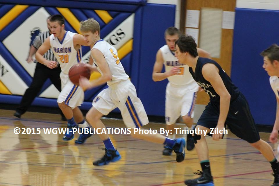
Boys Basketball – Marion VS Nekoosa 12-22-15

Written By: Timothy Zilch Photo’s By: Timothy Zilch

FINAL SCORE:

Marion: 54

 Nekoosa:  79


_________________________

PHOTO’S


12021723_1545234912463365_773889702_n//embedr.flickr.com/assets/client-code.js702963_1545234885796701_1665203623_n//embedr.flickr.com/assets/client-code.js12398921_1545234705796719_978202054_n//embedr.flickr.com/assets/client-code.js12404287_1545234702463386_1705707430_n//embedr.flickr.com/assets/client-code.js12421638_1545234752463381_1317790634_n//embedr.flickr.com/assets/client-code.js12431236_1545234872463369_868580418_n//embedr.flickr.com/assets/client-code.js12431767_1545234765796713_1326892636_n//embedr.flickr.com/assets/client-code.js12431286_1545234729130050_243398661_n//embedr.flickr.com/assets/client-code.js

Green Bay – House Fire 12-21-15

FROM: Green Bay Metro Fire Department  Public Information Officer Lt. Nick Craig 

00


Incident Date: 12/21/2015
Incident Type: Single Family Home Fire
Incident Address: 300 Block Bader St.
Incident Time: 8:15 AM
Incident Description: Ranch Home
Cause of Fire: Dehumidifier Malfunction
Origin of Fire: Basement
Estimated Dollar Loss: $70.000
Injuries: None
Number of People Displaced: 1

Additional Information: Resident had working smoke alarms in the home which alerted him to the fire. It is unknown if the dehumidifier that caused this fire was on the recall list from 2013. We urge residents to check their dehumidifiers to make sure they are not involved in the recall. This the 3rd dehumidifier caused fire that occurred this year in Brown County.

Green Bay – House Fire 12-17-15

From: Green Bay Metro Fire Department Battalion Chief: Chris Ehmann

Incident Date: 12/17/2015
Incident Type: House Fire
Incident Address: 11xx 12th Ave.
Incident Time: 23:14
Incident Description: Bedroom fire on 1st floor
Cause of Fire: Under Investigation by Fire Marshalls Office.
Origin of Fire: 1st Floor Bedroom
Estimated Dollar Loss: $40,000
Injuries: 2 cats deceased
Number of People Displaced: 2

Additional Information: Arrived to find fire coming from 1st floor bedroom window. No one home when fire started. Occupant arrived home and found fire showing from window. Report that occupants location were unknown so a search had to be done and it found no one was inside. Fire controlled within 10 minutes. Confined to bedroom with significant heat and smoke damage to the rest of the 1st floor. 2 cats perished in the fire. Red Cross assisting the 2 occupants.

Anyone willing to help the family please click here for more information

Girls Basketball – Bowler VS Marion 12-15-15

PHOTO’S & SCORE BY: Timothy Zilch

FINAL SCORE: Bowler 44 Marion 31


PHOTO’S

________________________________________

12395653_1540476956272494_1967004977_n//embedr.flickr.com/assets/client-code.js12395488_1540476946272495_1242161831_n//embedr.flickr.com/assets/client-code.js12395497_1540476952939161_1405684349_n//embedr.flickr.com/assets/client-code.js12395392_1540476819605841_1352696564_n//embedr.flickr.com/assets/client-code.js12395245_1540476949605828_1946503329_n//embedr.flickr.com/assets/client-code.js12395222_1540476969605826_1721852830_n//embedr.flickr.com/assets/client-code.js12387963_1540476992939157_659637816_n//embedr.flickr.com/assets/client-code.js12387940_1540476962939160_2102720883_n//embedr.flickr.com/assets/client-code.js12380621_1540476809605842_1285366651_n//embedr.flickr.com/assets/client-code.js12380543_1540476832939173_134757391_n//embedr.flickr.com/assets/client-code.js12380464_1540476916272498_610452367_n//embedr.flickr.com/assets/client-code.js12367111_1540476826272507_667257078_n//embedr.flickr.com/assets/client-code.js12366950_1540476836272506_498415054_n//embedr.flickr.com/assets/client-code.js12366606_1540476922939164_1106419959_n//embedr.flickr.com/assets/client-code.js12366589_1540476816272508_697517576_n//embedr.flickr.com/assets/client-code.js10311872_1540476829605840_453781069_n//embedr.flickr.com/assets/client-code.js12380543_1540477002939156_231414744_n//embedr.flickr.com/assets/client-code.js12387946_1540476942939162_729357986_n//embedr.flickr.com/assets/client-code.js12388185_1540476802939176_1266105371_n//embedr.flickr.com/assets/client-code.js

Green Bay – Rain and flooding update 12-14-15

FROM: Lt. Nick Craig  Green Bay Metro Fire Department Public Information Officer

Rain and flooding update


Green Bay, WI, December 14, 2015—-The Green Bay Metro Fire Department responded to one call for flooding at a residence this morning and saw many flooded streets in the City of Green Bay and the Village of Allouez.  Allouez reported several basements that were flooded. 

With the ground being saturated at this point and rain predicted for this Wednesday, we are urging residents to make sure that their sump pumps are in working order and functioning properly.  We would also recommend finding alternate routes if roadways are flooded today or on Wednesday.

The Green Bay Metro Fire Department is working closely with Brown County Emergency Management and the Public Works Departments of Green Bay and Allouez to monitor the rain and flooding issues that may occur later today or later this week.


Clintonville – Flooding Pictures 12-14-15

Photo’s & Written By: Timothy Zilch

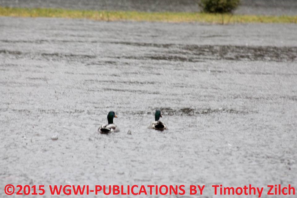
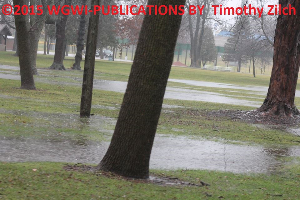
Photo’s Monday Morning Clintonville W.A. Olen Park. Please avoid the area until the water levels go down. Please keep Children away as well.  Hard to believe its December 14th usually we worry about the park flooding in spring. 


PHOTO’S

______________________________________

12244089_1539602613026595_2104648415_n//embedr.flickr.com/assets/client-code.js12336033_1539602443026612_404272849_n//embedr.flickr.com/assets/client-code.js12357981_1539602376359952_2041871210_n//embedr.flickr.com/assets/client-code.js12358013_1539602519693271_180062718_n//embedr.flickr.com/assets/client-code.js12358159_1539602723026584_5897490_n//embedr.flickr.com/assets/client-code.js12366840_1539602389693284_354839036_n//embedr.flickr.com/assets/client-code.js12366924_1539602563026600_347709967_n//embedr.flickr.com/assets/client-code.js12367010_1539602656359924_1779560809_n//embedr.flickr.com/assets/client-code.js12367097_1539602603026596_1028777849_n//embedr.flickr.com/assets/client-code.js12380244_1539602719693251_602366228_n//embedr.flickr.com/assets/client-code.js12386631_1539602649693258_1662138212_n//embedr.flickr.com/assets/client-code.js12386658_1539602363026620_1246745898_n//embedr.flickr.com/assets/client-code.js12387747_1539602629693260_1394092880_n//embedr.flickr.com/assets/client-code.js12387967_1539602606359929_2029106340_n//embedr.flickr.com/assets/client-code.js12387994_1539602369693286_984188634_n//embedr.flickr.com/assets/client-code.js12388183_1539602516359938_1611606321_n//embedr.flickr.com/assets/client-code.js12388199_1539602536359936_337197004_n//embedr.flickr.com/assets/client-code.js12395186_1539602583026598_1887894674_n//embedr.flickr.com/assets/client-code.js12395396_1539602566359933_1893857308_n//embedr.flickr.com/assets/client-code.js12395500_1539602569693266_1646265357_n//embedr.flickr.com/assets/client-code.js12395594_1539602639693259_332563689_n//embedr.flickr.com/assets/client-code.js

Girls Basketball – Tigerton VS Tri-County 12-11-15

Photo’s & Scores By: Timothy Zilch


JV:                                 1ST                          2ND
________________________________
Tigerton:                       34                             64
Tri-County:                    8                                27

Varsity:                         1ST                         2ND
_________________________________
Tigerton:                       11                             25
Tri-County:                  35                            63

________________________________________________________

PHOTO’S FROM THE GAME:

12272541_1538112756508914_366170477_n//embedr.flickr.com/assets/client-code.js12351029_1538113049842218_778292556_n//embedr.flickr.com/assets/client-code.js12351157_1538112949842228_168229072_n//embedr.flickr.com/assets/client-code.js12366764_1538112529842270_1583104483_n//embedr.flickr.com/assets/client-code.js12366890_1538112803175576_1058274058_n//embedr.flickr.com/assets/client-code.js12366954_1538112819842241_1351780337_n//embedr.flickr.com/assets/client-code.js12380166_1538113059842217_2085691616_n//embedr.flickr.com/assets/client-code.js12351217_1538112839842239_1316191790_n//embedr.flickr.com/assets/client-code.js12366871_1538113549842168_1570698363_n//embedr.flickr.com/assets/client-code.js12380323_1538112536508936_1875035834_n//embedr.flickr.com/assets/client-code.js12380501_1538113543175502_25033382_n//embedr.flickr.com/assets/client-code.js12386620_1538112946508895_342669693_n//embedr.flickr.com/assets/client-code.js12386663_1538112963175560_1997562896_n//embedr.flickr.com/assets/client-code.js12386707_1538113466508843_1361893678_n//embedr.flickr.com/assets/client-code.js12387839_1538112953175561_998744954_n//embedr.flickr.com/assets/client-code.js12388161_1538113033175553_283350602_n//embedr.flickr.com/assets/client-code.js12351145_1538112806508909_1501099377_n//embedr.flickr.com/assets/client-code.js